

At the Ketzin site, sandstone layers in the Stuttgart Formation were used for CO2 storage. The geological unit of the Stuttgart formation extends from northern Germany to the Stuttgart area, and was deposited in the Keuper layer during the Upper Trias Era, about 225 million years ago. In Ketzin, the Triassic deposits are covered by about 600 m of additional sediment.
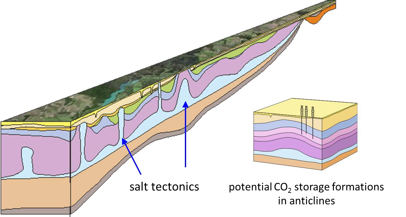
As in many other parts of northern Germany, the deposit of these sediments caused shifting in the large underground salt masses (salt tectonics) that were deposited in the Permian layer about 255 million years ago. As a result of this movement, salt pillows, salt walls and diapirs were created, deforming the rock layers above them and leading to the formation of depressions (synclines) and arches (anticlines)
")
The Ketzin site is located above one of these geological anticlines (Ill. 1). The CO2 was injected on the south side of this arched structure, at a depth of about 630 to 650 m. The storage sandstone in the Stuttgart Formation is covered by about 165 m of clay-stones, which create a seal (Ill. 2). Above the CO2 storage cap rock, at a depth of about 250 to 400 m, is sandstone from the Jurassic Period, which was formerly used as storage for city gas and natural gas. This layer in turn is covered by a cap rock about 80 to 90 m thick, made of Tertiary Rupelian clay. This clay plays an especially important role as a groundwater dam, preventing the salinization of the usable groundwater near the surface.
Together with the anticlinal structure, this multibarrier system ensures that the CO2 migrates in a controlled and limited way.
")
The entire Stuttgart Formation was layered on top of a fluvial system. The sandstone deposits represent the former riverbeds and consist mainly of quartz and feldspar, as well as smaller rock fragments. The sandstone is fine- to medium-grained and well sorted, although the sandstone grains are only loosely connected to one another. The binding cement is mainly made up of analcime and anhydrite as well as iron oxide, dolomite, clay minerals and a small amount of salt (halite). The sandstones have a porosity of 13 to 26%. A permeability of 50 to 100 mD (D - Darcy is a unit measuring permeability) was demonstrated in hydraulic tests; inspections of the core samples showed permeability from 500 to more than 1000 mD.